How digitalisation helps in ports’ environmental management
How digitalisation helps in ports’ environmental management
As environmental regulations tighten and climate impacts intensify, ports need clearer insights and better data to manage their responsibilities.
Ports around the world are under increasing pressure to decarbonise, reduce pollution, and strengthen environmental governance. Regulatory frameworks such as the International Maritime Organization’s GHG reduction strategy set ambitious targets for emissions reductions, energy transitions, and improved reporting practices. At the same time, societal expectations demand cleaner port operations, transparent reporting, and minimal environmental impact.
But modern environmental responsibility in ports is not only about emissions. Climate change is reshaping operational risk profiles, requiring ports to prepare for more severe storms, higher sea levels, flooding, and stress on aging infrastructure.
Managing these intertwined priorities like environmental performance and climate resilience is increasingly recognised as a data challenge. Port authorities need accurate, harmonised, real-time information to anticipate risks, measure impacts, comply with regulations, and guide long-term planning.
In this context, digitalisation is rapidly becoming a core capability for sustainable and resilient port management. And this is where systems like GISGRO play an enabling role, combining GIS, operational data integration, and domain-specific workflows such as traffic emission calculations.
Why environmental management in ports requires digital foundations
Environmental specialists highlight that meeting modern environmental targets depends on integrated, data-driven decision-making. Key trends shaping this shift include:
- Real-time environmental monitoring and analytics
Many ports are adopting digital tools and sensor-based systems to monitor air and water quality, noise, waste flows, dredging activity, and energy consumption. This reduces reliance on periodic manual assessments and supports proactive environmental management. - Data-driven operational optimisation
Analytics and modelling allow ports to optimise vessel traffic flows, berth usage, and dredging schedules — actions that directly reduce fuel consumption, emissions, and environmental disturbance. - Increased transparency and compliance requirements
Regulators, municipalities, and communities expect detailed data on emissions, environmental impacts, and compliance. Digitalisation makes audits, reporting, and disclosure more accurate and less time-consuming. - Integration across operational and environmental systems
Ports are evolving from simple logistics nodes to transport, energy, and information hubs, requiring better synchronisation of operational data and environmental performance indicators. - Climate adaptation and resilience planning
As climate risks intensify, ports need tools to evaluate physical vulnerabilities, forecast impacts, plan adaptation measures, and support rapid operational response.
Collectively, these trends show that environmental sustainability and climate resilience cannot be achieved through manual processes or isolated systems. A digital foundation is essential.
What GISGRO offers for environmental and emission monitoring
With this broader context in mind, it’s important to describe GISGRO’s role accurately.
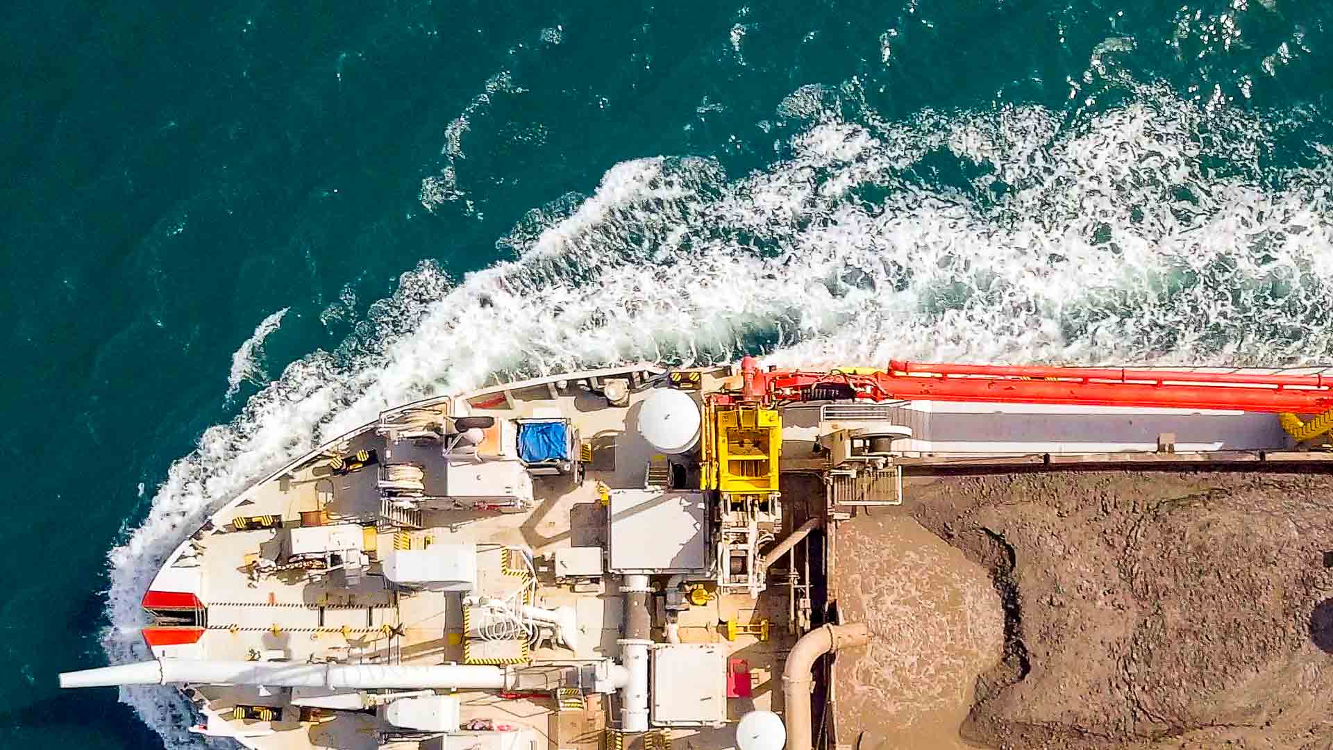
GISGRO Green focuses specifically on emission calculations for traffic in the port area, particularly vessel traffic during navigation and berthing and landside traffic such as trucks or working machinery.
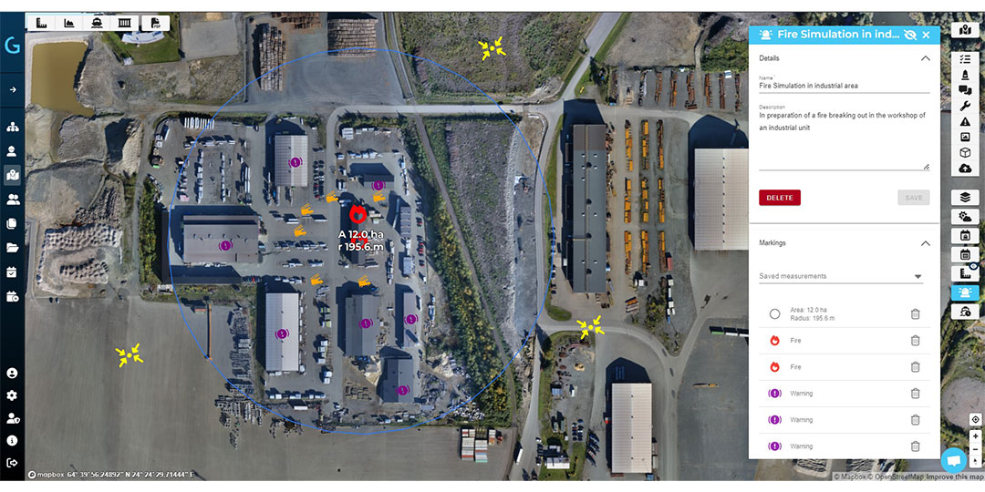
The broader GISGRO platform, which is GIS-based, supports spatial data management, operational awareness, asset mapping, bathymetry, and cross-departmental collaboration.
Together, these tools enable ports to strengthen their environmental management capabilities in a structured and incremental way.
GISGRO Green provides concrete first step in emission baseline creation
Vessel traffic emissions account for a significant share of a port’s overall environmental footprint. As regulatory expectations around transparency, monitoring, and reporting continue to tighten, ports are under increasing pressure to understand and document these emissions in a consistent and reliable way.
Accurate emission baselines are becoming essential not only for assessing impacts on local air quality, but also for shaping long-term decarbonisation strategies and evaluating the effectiveness of measures such as shore power and alternative fuels. In addition, emission data linked to individual port calls and traffic patterns helps ports understand how operational changes influence environmental performance. Taken together, these insights form an important foundation for meeting current requirements and preparing for future national and international environmental policy frameworks.
GISGRO Green provides these emission calculations in a structured, repeatable way, giving ports a factual basis for planning and monitoring improvement.
GIS-based spatial management is the foundation for broader environmental workflows
Beyond emissions-related analysis, a well-structured spatial data layer is a key enabler for everyday port management and longer-term environmental planning. A GIS-based environment allows ports to maintain up-to-date and reliable maps of critical infrastructure, providing a clear overview of assets and their locations.
When spatial information is combined with condition and lifecycle data, it becomes easier to monitor infrastructure health and plan maintenance or renewal activities in a more systematic way. In addition, visualising operational zones, safety areas, and environmental buffers within the same spatial context supports safer and more coordinated decision-making. By integrating external datasets such as flood-risk areas, protected zones, or energy infrastructure ports can also place their own operations within a broader environmental and regulatory framework, improving both planning and compliance.
This spatial foundation supports a wide range of environmental tasks that are easily visualized and shared with the necessary stakeholders.
The practical benefits of a digital approach for port environmental management
Many ports are still at an early stage of their digitalisation journey, and environmental management systems are rarely introduced through a single, all-encompassing project. Instead, progress typically happens step by step. A modular digital approach supports this gradual transition by allowing ports to begin with concrete use cases like emission calculations for vessel traffic, while at the same time establishing a reliable spatial data foundation that can be expanded over time.
As data becomes more structured and accessible, ports are better positioned to support evidence-based environmental reporting, prioritise investments, and develop climate adaptation strategies. In day-to-day operations, improved data visibility also helps reduce inefficiencies such as idle time, unnecessary dredging, or duplicated work, which in turn lowers emissions and environmental impacts. As regulatory requirements and monitoring needs evolve, a GIS-based platform offers the flexibility to integrate additional data sources or new environmental workflows without having to replace existing systems.
Sustainability is no longer an isolated function in ports. It is closely connected to operations, safety, infrastructure, and climate strategy. With the right digital tools, ports can move toward a future where environmental performance and operational continuity reinforce one another rather than compete.
Ready to take the first step?
If you have sustainability targets to meet, we would love to discuss! Send us a message to describe your ideas and let’s start the journey together.
Book A Demo
How Gisgro helps your work
At Gisgro, we know that each role within a port comes with its own unique challenges and requirements. Discover how Gisgro can enhance your work by exploring benefits it provides for your role—transforming complex port data into clear, actionable insights that empower you to take full control.
CEO
Harbor and Marine Operators
Land operations / Technical
Commercial
Services
GIS / CAD
IT
Finance & Accounting
View all user groups
Real people. Real support.
Whether you’re curious about how GISGRO could work for your port or you’re ready to take the next step, we’d love to hear from you. Our team is friendly, experienced, and happy to help.
Just fill out the form and we’ll get back to you soon.