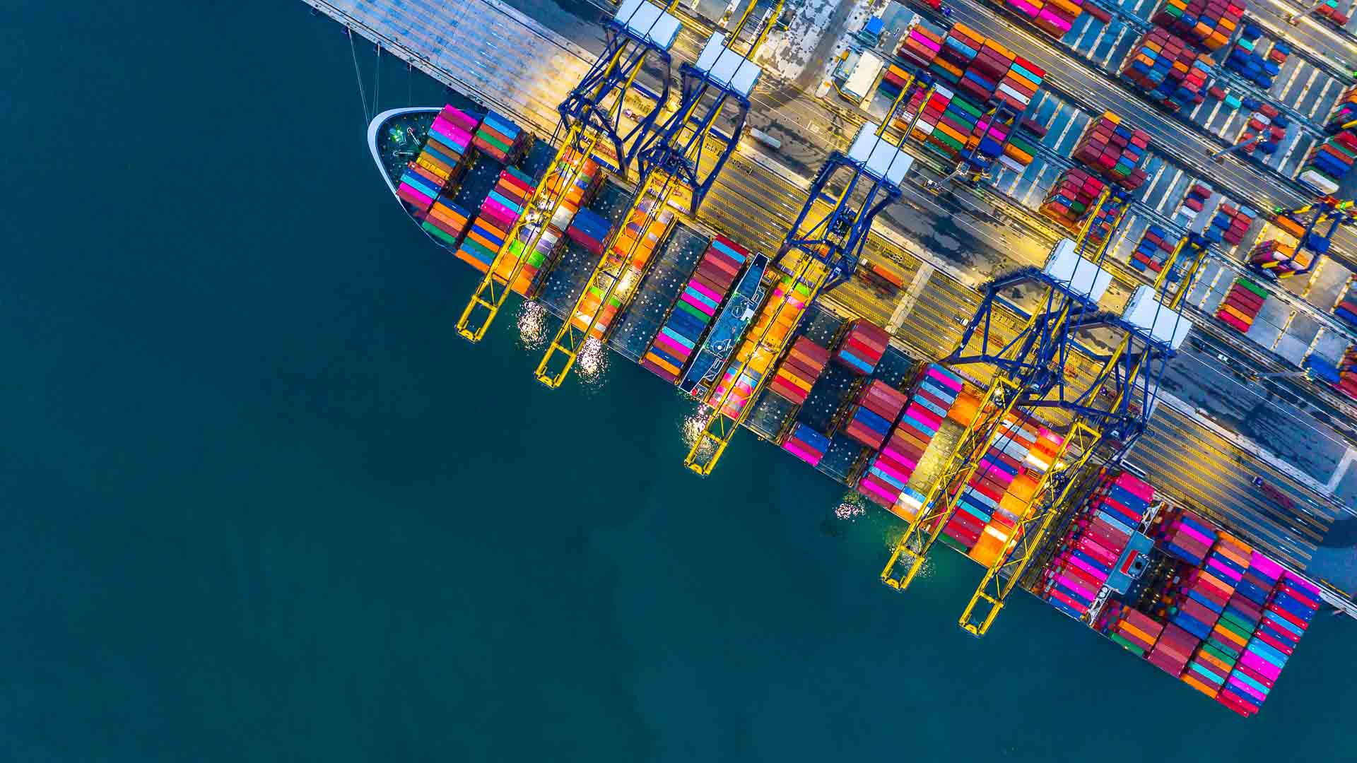
Vessel planning, the beating heart of port operations
Every port call is more than a simple arrival or departure. It represents revenue, stakeholder coordination, and the lifeblood of the port’s daily activity. Without efficient vessel planning, ports risk congestion, delays, safety concerns, and lost opportunities.
From whiteboards to data-driven decisions
Historically, ports relied on surprisingly manual approaches to allocate berths and plan vessel movements. Paper charts, rulers, whiteboards, and even physical models were the everyday tools of planners. These methods demanded constant updates and offered little room for error, yet they laid the foundation for modern planning.
Even today, some ports still use spreadsheets or analogue systems to manage complex vessel schedules. While these methods have served their purpose, they cannot keep pace with the scale, speed, and transparency now expected in global trade.
The challenge for ports today
The shipping industry is moving faster, with larger vessels, stricter regulations, and tighter margins. Ports must juggle more data, more stakeholders, and more variables than ever before. Manual methods, or even siloed digital systems, make it difficult to ensure accuracy and avoid costly miscommunication.
The good news is that digital transformation does not need to be overwhelming. Whether a port is still using whiteboards or already experimenting with digital tools, GISGRO can help them take the next step.
How integrated PMIS solutions support modern port operations
Integrated Port Management Information Systems (PMIS) are transforming how ports manage infrastructure, operations, and data. By bringing vessel traffic planning, asset information, and stakeholder communication into one unified platform, ports can improve efficiency and decision-making, without needing to overhaul everything at once.
A modern PMIS like GISGRO provides the foundation for coordinated, efficient vessel planning. Whether visualising berths or automating traffic schedules, an integrated PMIS connects people, data, and systems in real time. Here are some practical examples of how GISGRO helps ports make vessel planning more efficient:
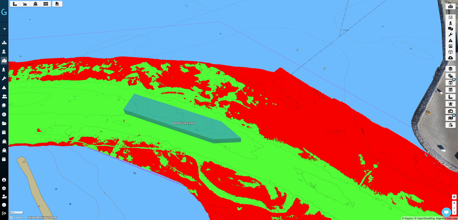
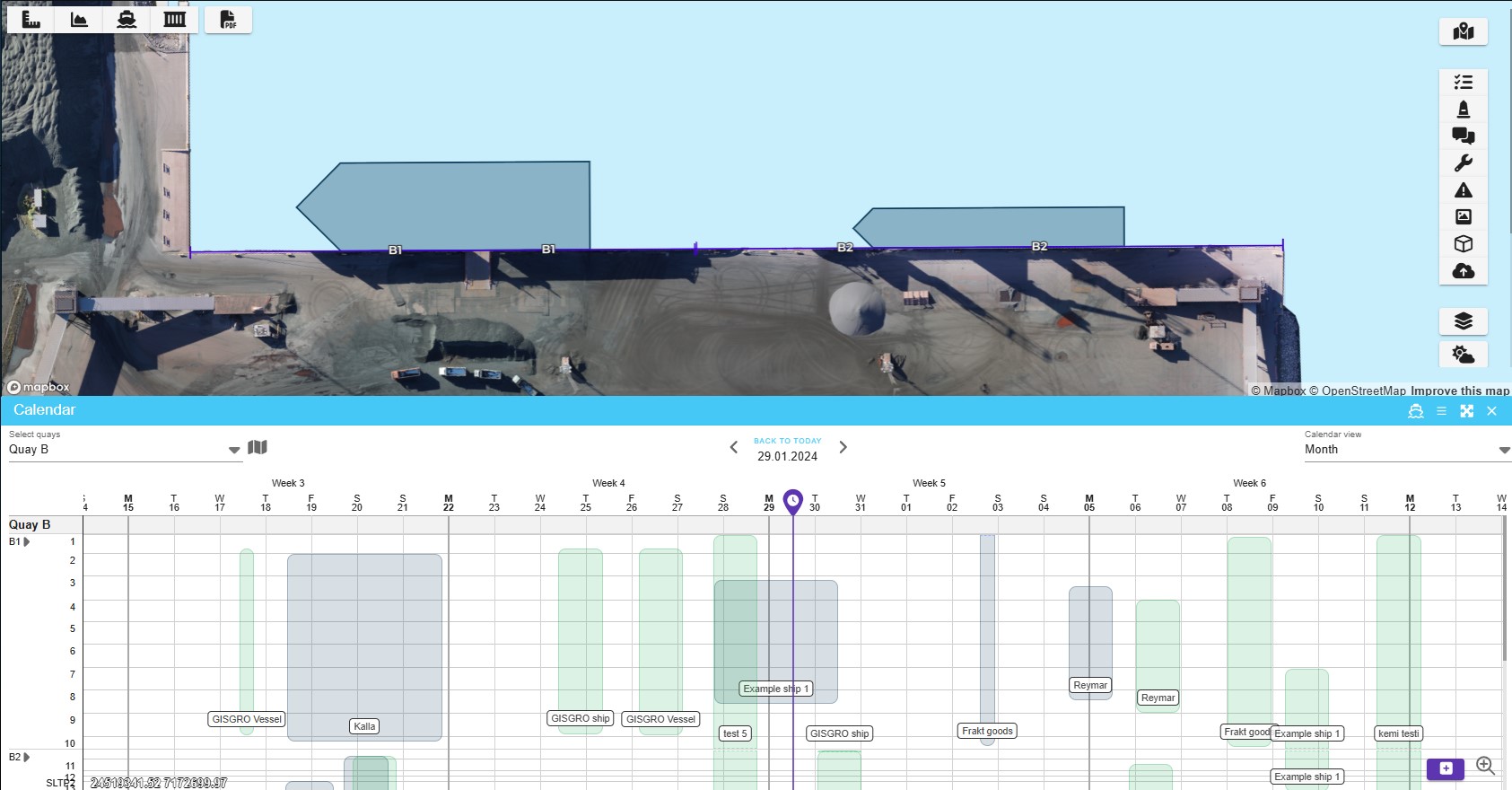
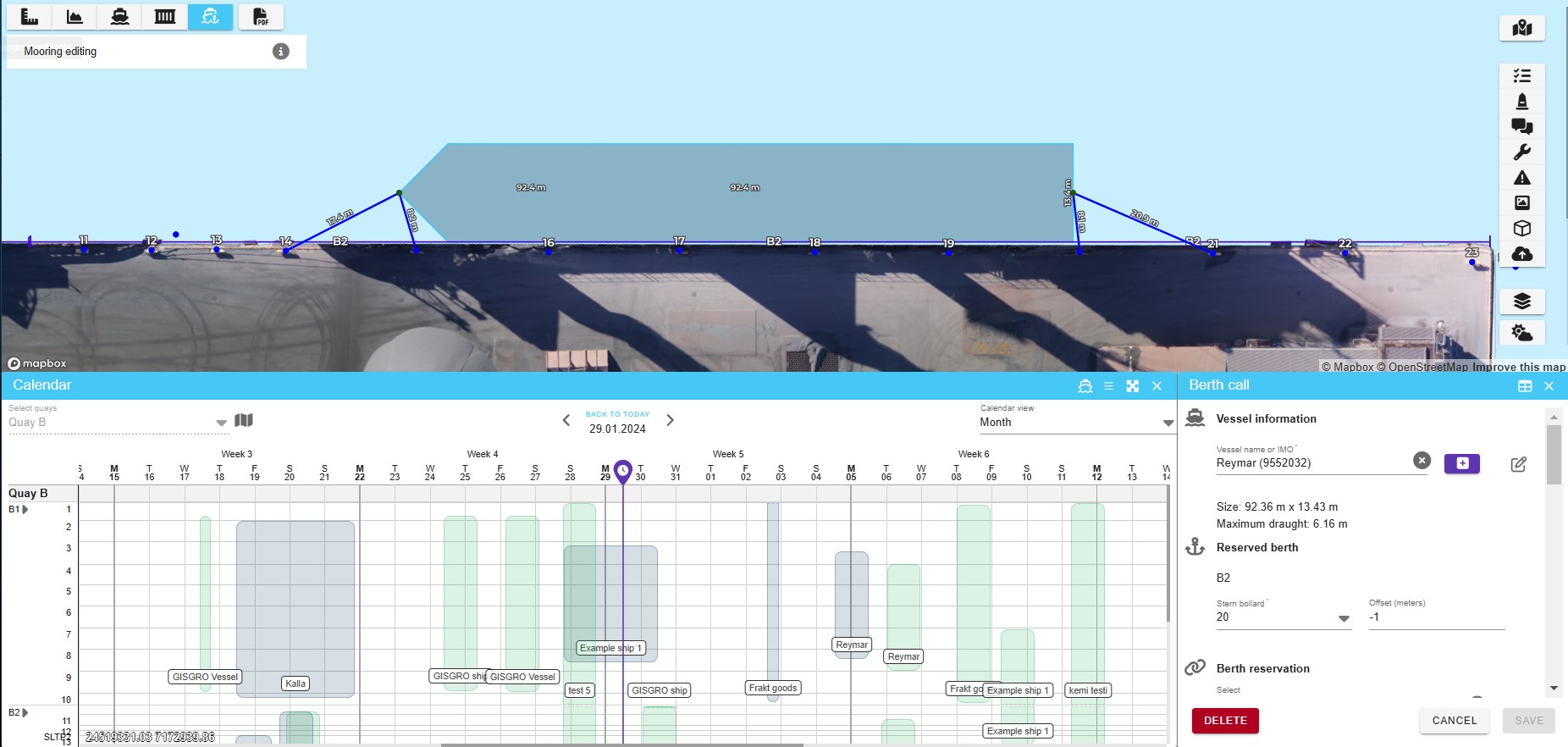
Map-based berth planning with a digital twin
GISGRO’s first berth planning tool offers a practical way for ports to move from manual planning into digital visualisation. Using your digital twin, you can:
• Place vessels directly onto the port map for instant clarity • Highlight maritime assets and infrastructure at specific berths • Overlay bathymetric charts to ensure safe allocation • Create shareable, printable maps for clear communication
If you are currently using spreadsheets or whiteboards, how helpful would it be to see vessel allocation directly on a map?
“GISGRO allows us to efficiently and easily plan port calls, communicating essential information to our clients and workforce. Whether it be planning fendering requirements, confirming under keel clearance or determining storage areas for laydown the platform is providing valued solutions on a daily basis. GISGRO invested substantial time for us in setting up the trial account, which allowed us to see the system at work with our own data first – making it clear that this was the right step forward in our Smart Port development.”
Tim Sykes, Marine Operations Manager in A&P Falmouth
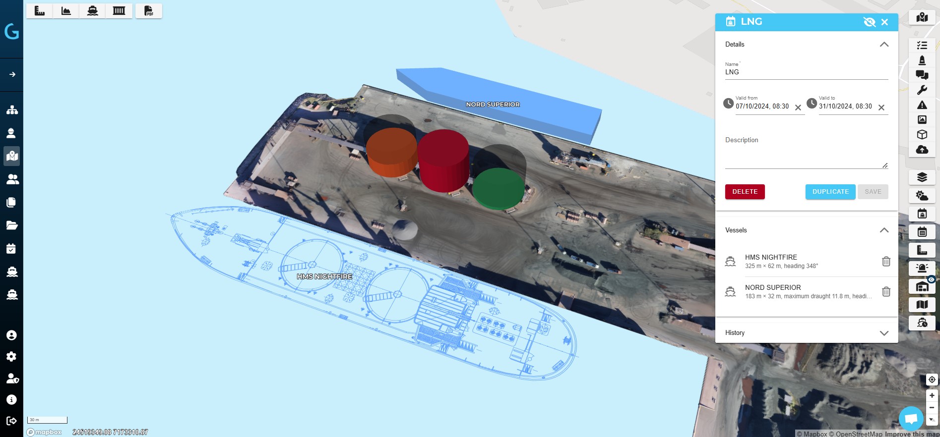
Advanced vessel traffic management with PMIS
For ports needing deeper operational control, GISGRO’s Vessel Traffic module takes planning to the next level. By consolidating port call data into one platform, it enables:
• Real-time visualisation of past, present, and upcoming calls • Integrated AIS and environmental data for accurate decisions • Manual and automated scheduling, reducing duplication of effort • Automated stakeholder updates to cut miscommunication • Data analytics to continuously monitor and optimise performance
The module is also tightly linked with the Community module, allowing berth reservations and service requests from agents to flow directly into the planning process. The result is transparency, efficiency, and confidence across all stakeholders.
How valuable would it be if your scheduling system could update automatically and notify stakeholders in real time?
“The Vessel Traffic module within GISGRO has transformed how we manage port calls and vessel movements. What previously required hours of coordination and manual effort can now be completed in just minutes. Having a complete, real-time overview of maritime traffic enables us to make faster, more informed decisions that improve both operational efficiency and safety across the harbour.”
Adaptive berth allocation in real-world conditions
Ports operate in dynamic environments where rarely everything goes exactly to plan. Weather disruptions, vessel breakdowns, last-minute delays, or unexpected service requests can all throw carefully arranged schedules off balance. In these situations, the ability to make quick, accurate, and well-informed decisions is essential to keeping operations safe and efficient.
GISGRO supports ports by factoring in a wide range of variables when suggesting the best available berth. The system’s automated decision-making capabilities allow planners to rapidly adjust allocations in response to changing circumstances, while still considering safety requirements, operational constraints, and commercial priorities.
Instead of relying solely on manual updates, GISGRO evaluates multiple possibilities in real time, helping port operators identify the most suitable option instantly. This not only reduces the risk of congestion and miscommunication but also ensures that stakeholders can respond with confidence, even when conditions shift unexpectedly.
Imagine the difference it makes when your system can recommend the safest and most efficient berth under pressure, saving time, reducing stress, and avoiding costly delays.
Looking ahead
Ports that embrace digital vessel planning are not just improving efficiency, they are shaping the future of maritime logistics. Moving from paper charts to data-driven planning is more than a technological upgrade, it is a cultural shift towards smarter, safer, and more sustainable port operations.
The important message is that no port is too far behind. With GISGRO, digital transformation is a journey that begins from where you are now. Whether through map-based berth allocation or advanced traffic management, the goal is the same: to help ports run smoother, safer, and stronger.
Want to see how GISGRO can support your digital transformation? Book an online demo meeting and let’s explore what’s possible together.
Book A Demo
How Gisgro helps your work
At Gisgro, we know that each role within a port comes with its own unique challenges and requirements. Discover how Gisgro can enhance your work by exploring benefits it provides for your role—transforming complex port data into clear, actionable insights that empower you to take full control.
Whether you’re curious about how GISGRO could work for your port or you’re ready to take the next step, we’d love to hear from you. Our team is friendly, experienced, and happy to help.
Just fill out the form and we’ll get back to you soon.