
Connecting port infrastructure and real estate management with GIS
From damage report to maintenance action
Connecting port infrastructure and real estate management with GIS.
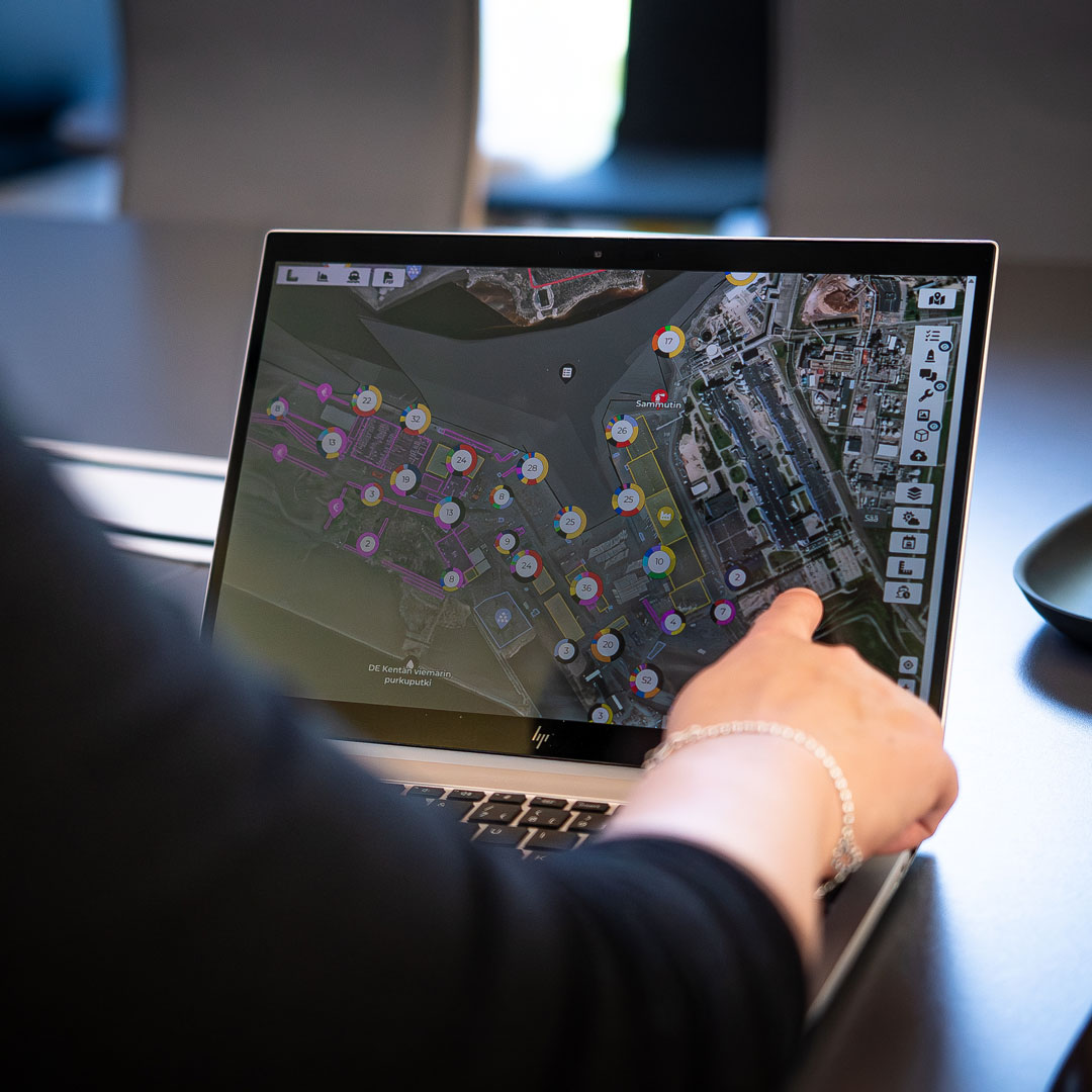
Managing port infrastructure involves much more than keeping an inventory of assets. Every quay, berth, warehouse, building and rental area has its own condition, operational role, maintenance needs and economic value. When this information is connected through GIS, individual observations and incidents can become part of a continuous process for maintaining, improving and managing the port’s infrastructure and real estate.
Ports depend on a wide variety of physical assets that are used every day, often under demanding conditions. Vessels put pressure on fenders and mooring structures, heavy equipment operates across quay areas, and changing weather and environmental conditions affect infrastructure over time. At the same time, buildings, warehouses, storage areas and other real estate assets need regular inspections, repairs and maintenance to remain suitable for their intended use.
Some maintenance needs can be anticipated, while others become visible only when an incident occurs, a tenant reports a problem or someone notices a defect during daily operations. Regardless of where the information originates, the challenge is to ensure that the observation reaches the right people, leads to the necessary action and becomes part of the asset’s history.
This is where GIS adds particular value. By connecting assets, properties, locations, inspections, incidents and maintenance activities in one visual environment, the port can manage not only individual tasks but also the condition, utilisation and lifecycle of its infrastructure and real estate.
From an incident to a maintenance action
Consider a fender damaged during a vessel call or a defect discovered in a warehouse rented by a port customer. The damage may first be noticed by port personnel during routine operations, reported by a tenant or discovered during a scheduled inspection. Although the circumstances are different, both situations require a similar process: documenting the problem, identifying the affected asset, assessing the damage and deciding what action is needed.
In a GIS-based system, the report can be connected directly to the relevant location and asset. Instead of describing the damaged fender, warehouse door or pavement only in an email or separate report, the person making the observation can identify the location on the port map and add photographs, notes and other relevant information.
The process creates a connected chain of information:
Incident or observation → Damage report → Assessment → Maintenance task → Completed repair → Updated asset record
Each stage builds on the information collected earlier, reducing the need to reconstruct what happened or search for documentation across different systems. Importantly, the process does not end when the repair is completed. The action becomes part of the asset’s maintenance history, providing useful information for future inspections and decisions.
Keeping infrastructure and real estate information up to date
Reliable asset management depends on knowing what the port owns, operates and maintains, as well as the current condition and use of those assets. However, an asset register is only as useful as the information it contains. A quay may have undergone repairs, equipment may have been replaced, or an inspection may have identified deterioration that affects how the asset should be used.
The same applies to real estate. A warehouse may have been renovated, a building’s technical systems upgraded, or a storage area divided into different rental units. Changes in tenancy, permitted use, contractual responsibilities or maintenance requirements can also affect how a property needs to be managed.
When these changes are recorded separately from the asset information, maintaining an accurate overview becomes increasingly difficult. The original asset or property record may still exist, but it no longer describes the current situation.
GIS connects this information to the physical asset or property itself. Technical specifications, floor plans, inspection reports, photographs, condition assessments, maintenance records and other relevant documentation can be linked to the asset’s geographical location and made available to the people responsible for managing it. For real estate, the same spatial context can help connect buildings and rental areas with information about tenants, agreements and their use.
For example, after repairing a damaged warehouse door, the maintenance team can update the relevant information so that the completed work and current condition are reflected in the building’s record. The property manager can then access the maintenance history in the context of the property and its use, rather than relying on a separate collection of documents.
This is an important distinction between storing infrastructure information and actively managing it. The objective is not simply to create a digital inventory, but to maintain a reliable and continuously developing picture of the port’s assets and properties.
Inspection planning: from reacting to anticipating
Not all infrastructure problems begin with an unexpected incident. Many can be identified through regular inspections, condition monitoring and planned maintenance. For port infrastructure and real estate alike, these activities are essential for maintaining safety, operational reliability and the long-term usability of assets.
Different assets naturally require different inspection approaches. Mooring equipment, quay structures, pavements and utilities have different characteristics and operating conditions. Buildings and warehouses introduce further requirements, such as inspections of roofs, doors, heating and ventilation systems, fire safety equipment and other technical installations.
A structured inspection plan helps ensure that these differences are considered and that inspections take place at appropriate intervals. It also helps coordinate maintenance responsibilities across different teams, contractors and, where relevant, tenants.
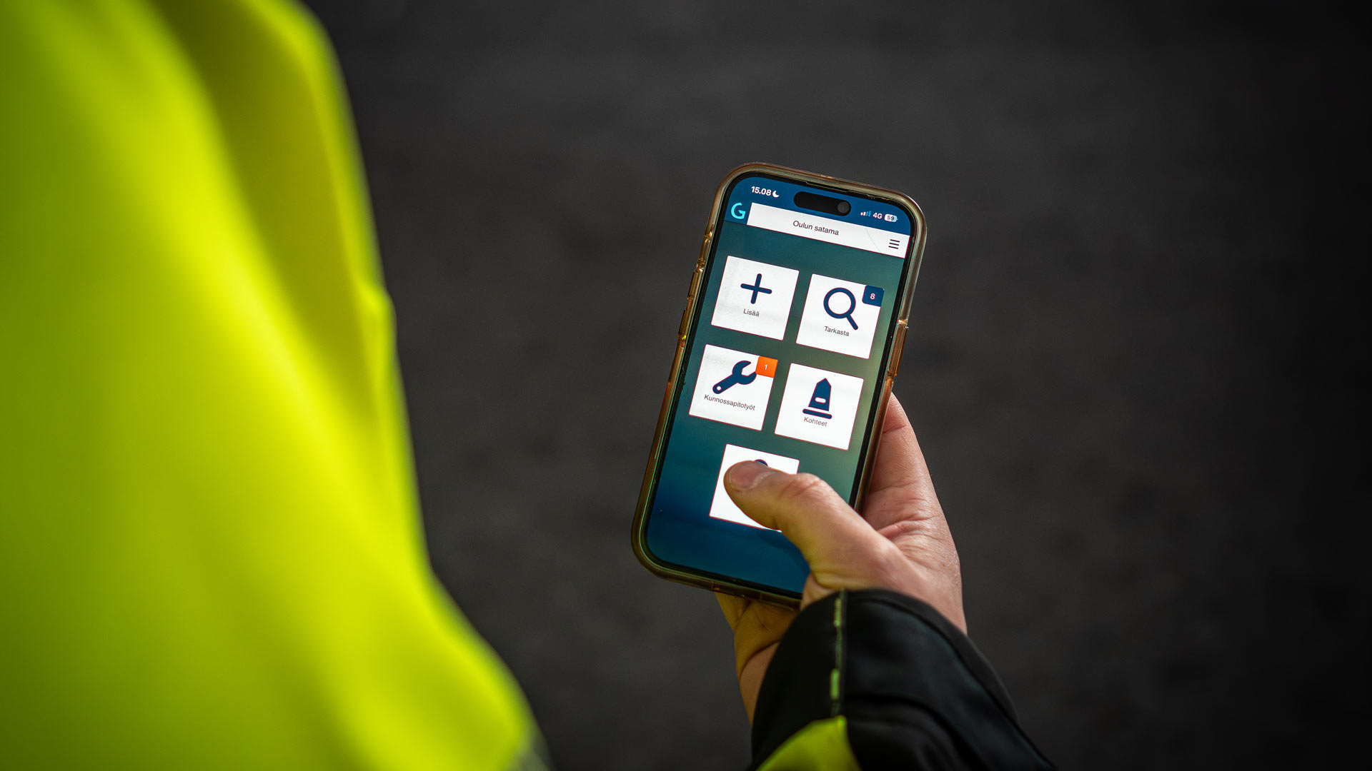
When inspection planning is connected to GIS, the work can be organised around the actual infrastructure and properties rather than separate task lists. Teams can identify the assets requiring inspection, locate them on the map, assign responsibilities and document findings directly against the relevant asset.
This creates a useful connection between planned inspections and corrective maintenance. If an inspection reveals a defect, the finding can become the starting point for a maintenance action without losing the original observation or its location. The same process can support both a damaged quay structure and a leaking warehouse roof.
As inspection results accumulate, they provide a more consistent understanding of how infrastructure and property conditions change over time. This supports decisions about which assets require closer monitoring, which repairs should be prioritised and where preventive maintenance may reduce the risk of more extensive damage.
Understanding maintenance costs in relation to asset value
Port infrastructure represents a significant investment, but its value is not determined only by construction costs or technical condition. Many assets also contribute directly or indirectly to the port’s revenue. Berths enable vessel calls and port services, storage areas may generate rental income, and buildings and warehouses can provide long-term revenue through lease agreements.
Maintenance therefore has an economic dimension alongside its operational and safety responsibilities.
A damaged asset may require immediate repair expenditure, but delaying maintenance can also affect its availability, usability or ability to generate revenue. For example, a warehouse requiring repeated repairs may create increasing maintenance costs while also affecting tenant satisfaction or the property’s suitability for future rental. Similarly, a storage area in poor condition may limit how effectively it can be used or rented.
Connecting infrastructure and real estate information with operational and commercial data creates opportunities to examine these relationships more closely. An infrastructure manager may want to understand the maintenance costs of a particular quay alongside its utilisation and service-related income. A property manager may be interested in the maintenance history and costs of a warehouse in relation to its rental income, occupancy and future renovation needs.
These comparisons do not replace technical assessments, property valuations or financial analysis, and they do not automatically determine an asset’s accounting value. However, they can provide a more complete basis for decisions about lifecycle costs, maintenance priorities, rental profitability and future investments.
The GIS connection is particularly useful because both the maintenance activities and the commercial use can be understood in relation to the same physical asset or property. Instead of considering costs, income, occupancy and condition as unrelated information, ports can begin evaluating them together.

Turning maintenance history into better infrastructure and property decisions
Individual damage reports and inspections are primarily concerned with the condition of an asset at a particular moment. Over time, however, they also create valuable historical information.
A recurring defect may indicate that a component is approaching the end of its useful life, that operating conditions are more demanding than expected or that a different maintenance approach should be considered. Similarly, repeated problems in a particular building may suggest that isolated repairs are no longer the most cost-effective solution and that a larger renovation should be evaluated.
GIS makes these relationships easier to examine spatially. Maintenance needs can be viewed in relation to specific berths, quay sections, buildings, warehouses, rental areas or other infrastructure, helping teams identify where problems occur and how they develop.
For real estate management, this historical perspective can also support decisions about property development and use. Understanding a building’s condition, maintenance history, rental arrangements and operating costs provides useful context when considering refurbishment, changes in use or future investments.
When condition information, maintenance history and costs are available together, ports can use that knowledge to support maintenance budgets, renovation programmes and long-term infrastructure and real estate planning. The same information that started as a report of a damaged asset can therefore contribute to decisions extending well beyond the original repair.
The value of the data grows as it becomes part of a consistent asset history rather than remaining an isolated record.
What this means in GISGRO
GISGRO combines Port GIS, maintenance management and connected PMIS functionality in one visual platform, allowing infrastructure and real estate information to be managed in the context of the physical port.
An incident or defect can be reported from the field and linked to the relevant location, asset or property. Maintenance tasks can be created and assigned, inspections planned, and the progress of repairs followed in the same environment. The resulting information remains connected to the asset’s digital record, supporting an up-to-date understanding of its condition, maintenance history and associated costs.
GISGRO’s GIS foundation also provides a natural connection between infrastructure management and real estate management. Berths, quays, buildings, warehouses, land plots and rental areas can be understood as parts of the same port environment, with their technical information, maintenance activities and relevant commercial relationships connected to their physical locations.
This creates a more useful basis for managing assets throughout their lifecycle, from individual observations and repairs to recurring inspections, maintenance planning and longer-term investment decisions. It also supports collaboration between operational, technical, commercial and property management teams, which may have different responsibilities but depend on information about the same assets.
For us, the real benefit of GIS-based asset management is that a damage report does not remain just a report, and a maintenance task does not remain just a task. Both become part of the connected information that helps the port protect, maintain and develop its infrastructure and real estate.
GISGRO – Control the data. Control the port.
Book A Demo
Real people. Real support.
Whether you’re curious about how GISGRO could work for your port or you’re ready to take the next step, we’d love to hear from you. Our team is friendly, experienced, and happy to help.
Just fill out the form and we’ll get back to you soon.