Our solution
One window. One helm.
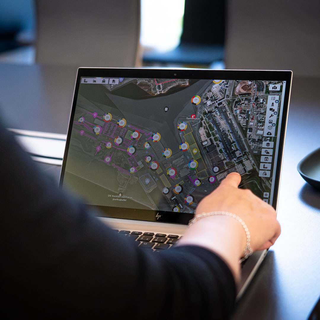
See all your port’s operations, assets, and data in one place. GISGRO gives you the control and clarity to manage everything. Seamlessly.

Smart technology for every port, no exceptions.
With GIS (Geographic Information Systems) and PMIS (Port Management Information Systems) combined into a single, visual digital-twin platform, GISGRO provides a unified solution for seamless port management. Through one window, you can visualize real-time mapping, track assets, manage scheduling, logistics, and streamline decision-making.
This all-in-one system reduces complexity, enhances communication between departments, and ensures better planning and operational efficiency. No need for multiple platforms—just one scalable system for total control over your port’s activities.
Adaptable by design – build your own smart port.
Every port is different – in size, in structure, and in how far along the digital path they are. That’s why GISGRO is modular. You can start with just what you need and expand as you go. Start small or scale wide. You’re in control.
Port GIS
Port GIS turns complex infrastructure data into a real-time, clear view, helping ports manage assets, plan smarter, and improve operational control.
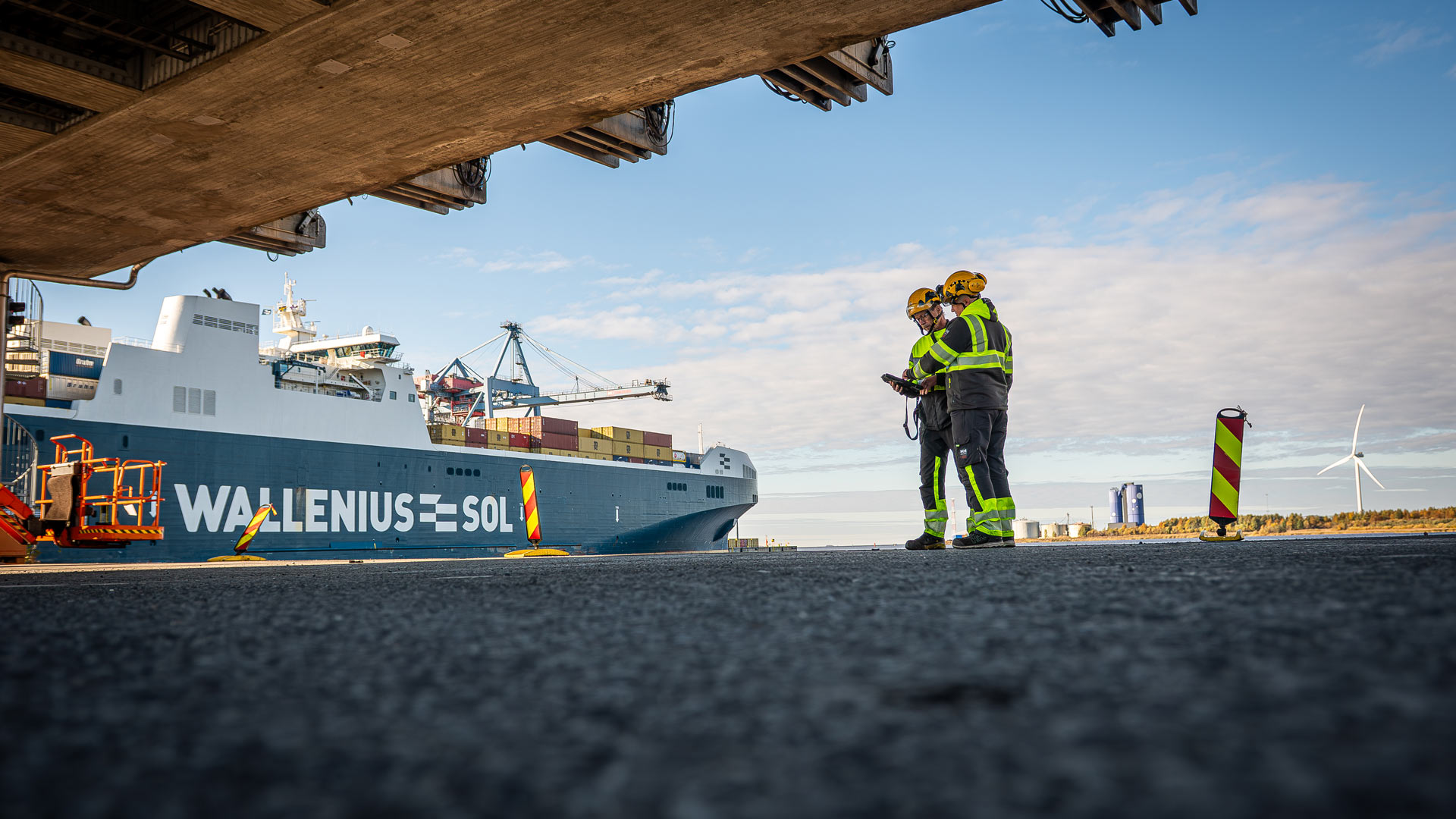
Vessel Traffic
Track, plan, and manage vessel movements in real time. Vessel Traffic helps ports streamline port calls, boost safety, and optimise berth usage.
Community
Community connects agents and port teams in one platform, making berth reservations and service requests faster, easier, and more accurate.
Services
Plan, track, and manage port services in one place. GISGRO Services replaces manual processes with real-time, accurate, and connected workflows.
Work Time Management
Work Time Management helps ports schedule, assign, and track shifts in one system – improving coordination, work hour tracking, and payroll accuracy.
Cargo Traffic
Cargo Traffic helps ports track handled cargo by type, volume, and timing. This ensures accurate invoicing, better reporting, and fewer errors.
Maintenance
The Maintenance module helps ports manage inspections, defects, and repairs in one system — improving safety, reducing downtime, and cutting paperwork.
Contracts
Contracts connects lease data with GIS, helping you manage estates proactively, avoid missed renewals, and get the most out of every square metre.
Invoicing
Invoicing links operational data to billing. Capture every charge, reduce admin work, and make sure no service goes unbilled.
Health & Safety
Bring safety activities into one clear system. Log incidents, manage emergency plans, and keep your port prepared with shareable, map-based tools.
Green
The GISGRO Green makes it easy to calculate and report vessel emissions using real data, helping ports support sustainability and meet compliance goals.
Smarter together: connected data, clearer decisions.
Whether you want to improve berth booking, manage maintenance, or visualise port infrastructure, each GISGRO module works independently but they work even better together. When connected, they share data seamlessly giving everyone from control room to quayside the same situational view. Vessel movements, service requests, inspections, and lease areas all link into one reliable source of truth. This means fewer silos, smarter decisions, and a clearer view of your port’s operations.


About the pricing of GISGRO
GISGRO is built to grow with your port. Start with the modules you need and expand as your operations evolve, without committing to a massive, upfront investment. Our modular pricing means you only pay for what you use, making it easier to get started and scale smartly.
GISGRO offers a modern, flexible software platform that fits ports of all sizes.
How to get started with GISGRO
Getting started with GISGRO is simple, and you’ll never be left guessing. We guide you through each step, so you can see real results, fast.
-
1.
Start with a conversation
Let’s talk about your port. We’ll show you how GISGRO works, answer your questions, and help you see what’s possible. All based on your real challenges and goals.
-
2.
Try GISGRO with your own data
We’ll set up a free trial tailored to your port, using your own data. That way, you can explore the platform in a way that’s relevant, useful, and easy to evaluate.
-
3.
Pick your modules and launch with support
You choose the features that matter. We’ll handle onboarding and training, so your team feels confident from day one, and gets real value, fast.
Port insights: real stories and fresh thinking.
Running a smarter port isn’t just about software, it’s about seeing what’s possible. Our Port Insights hub brings you stories from the field, views from industry experts, and practical ideas to help you take control of your port operations.
Explore how others are tackling common challenges, what’s shaping the future of port management, and how GISGRO fits into it all.

Real people. Real support.
Whether you’re curious about how GISGRO could work for your port or you’re ready to take the next step, we’d love to hear from you. Our team is friendly, experienced, and happy to help.
Just fill out the form and we’ll get back to you soon.