Saving time with port’s digital twin in Port of Raahe
Saving time with port’s digital twin in Port of Raahe
Port of Raahe saves time and resources with a GIS-based digital twin, streamlining planning, maintenance, and communication by centralizing asset data and enhancing operational efficiency across departments.

Port of Raahe is a great example on how to save time and resources with the help of digital tools. The port has digitised most of its areas and assets, and the information is used throughout the organisation in everyday work. Several days of working time is saved each time something is planned or inspected, by using the digital twin instead of field trips and trying to find scattered information around the office.
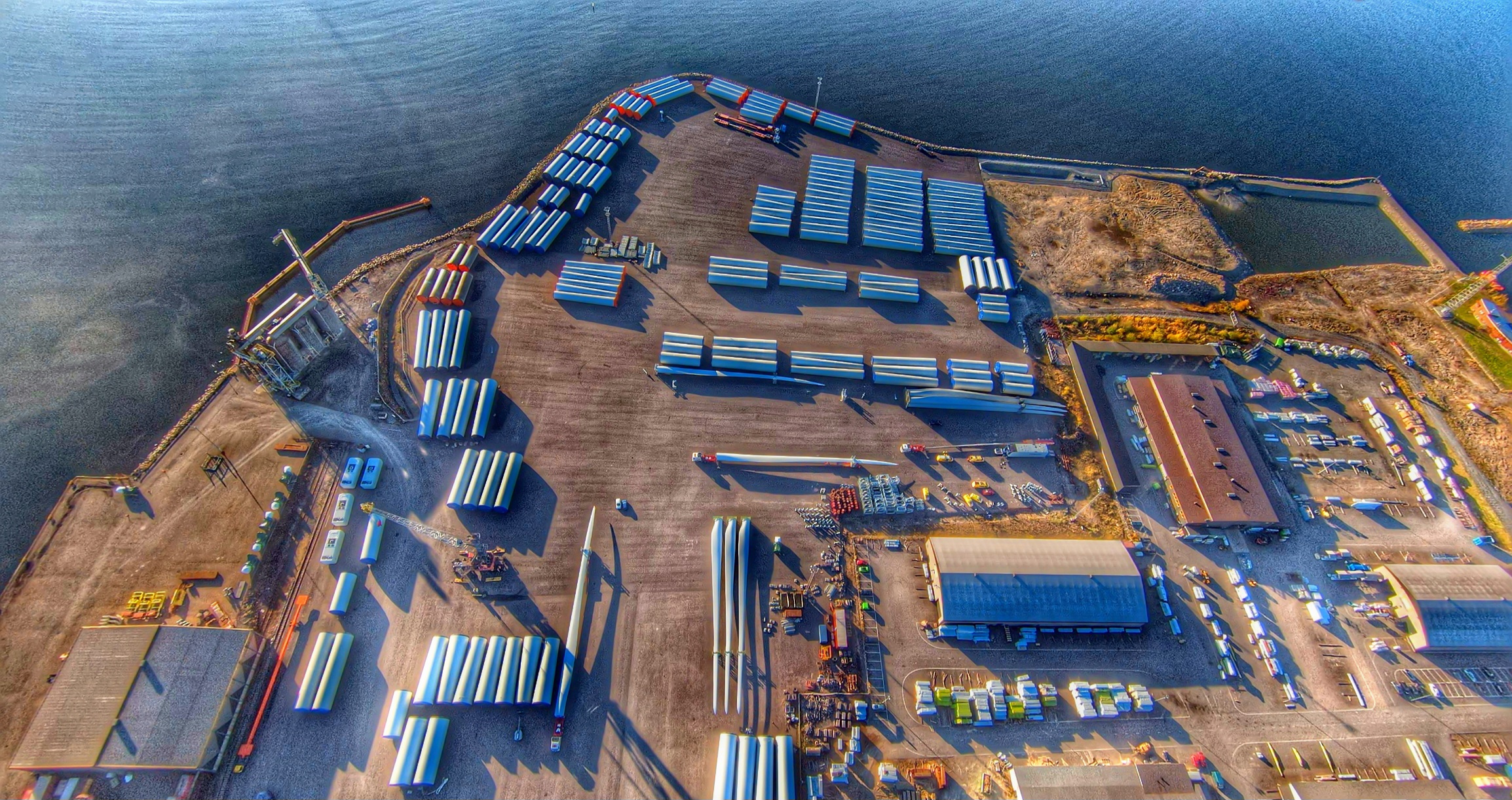
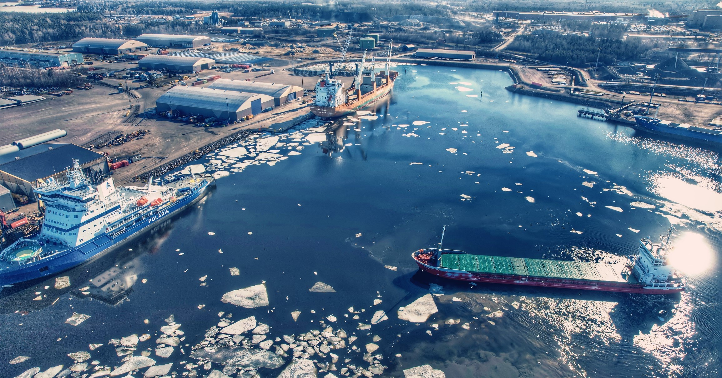
Port of Raahe is a busy cargo port in the west coast of Finland. With about 600 vessel visits per year Port of Raahe is an important transportation hub for bulk cargo, steel, and project cargo such as windmill parts. The port offers services from cargo handling to warehouses and puts strong effort on reliability and high quality of operations.
With digital twin information is easily accessible
Port of Raahe based their digital twin on photogrammetry data received from drone surveys. The drone data is updated every second year, so even though the port develops constantly, the map view has all the changes up-to-date and visible.
The port has also digitised all the GIS information on assets under and above ground and sea. The extensive data bank is still easy to use as the map layers can be switched on and off, depending on the information needed. Specially in planning different area development projects it is crucial to see what part of infrastructure lies under ground. Before implementing GISGRO Port GIS, the information had to be found from somewhere around the office or asked from external consultants or officials.
“It could take days to wait for the answer if you needed information on location of electricity cables or such, so every planning process was way longer than now with GISGRO. Now you just click the map open and there it is – seconds instead of days”, says Elma Mäyrä, Port Secretary in Port of Raahe.

Picture: Hooli Stevedoring Oy
Digital twin assists in planning and communication
A picture is worth a thousand words. The digital twin is used daily by port’s maintenance crew. The information on port’s assets is clearly visualised on the map and you can use measuring tools for area planning or see exactly where the underground pipeline is located. Communicating with the maintenance team or clients is much easier when you can show everything on the digital twin without leaving the office.
“I use GISGRO daily in my work, and it saves a huge amount of time not needing to go out measuring areas for example, but instead I can see all the important information on my screen and can decide if my plans fit to the area in question”, describes Netta Krekilä, Maintenance Manager in Port of Raahe.
“We are also adding more detailed maintenance information on assets, like inspection schedules and warranty sheets in GISGRO, so everything is found from the same platform”, she adds.
Adding more modules supports port management processes
Port of Raahe has also moved their invoicing and emission calculation processes in GISGRO. This has proven to be a good approach in digitalising port’s processes: starting with Port GIS and adding then more functionalities to support different parts of the port operations. The smoother the information flow is between the port’s departments, the more time is saved every day.
How Gisgro helps your work
At Gisgro, we know that each role within a port comes with its own unique challenges and requirements. Discover how Gisgro can enhance your work by exploring benefits it provides for your role—transforming complex port data into clear, actionable insights that empower you to take full control.
CEO
Harbor and Marine Operators
Land operations / Technical
Commercial
Services
GIS / CAD
IT
Finance & Accounting
View all user groups
Real people. Real support.
Whether you’re curious about how GISGRO could work for your port or you’re ready to take the next step, we’d love to hear from you. Our team is friendly, experienced, and happy to help.
Just fill out the form and we’ll get back to you soon.